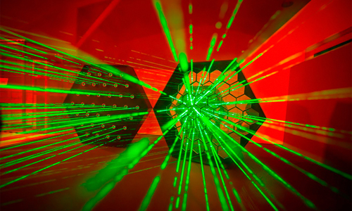



Novel lidar maps location, speed, and material type in single scan
University of Toronto expands lidar sensing; new options for robotics, auto-driving, and sensing.
22 June 2026
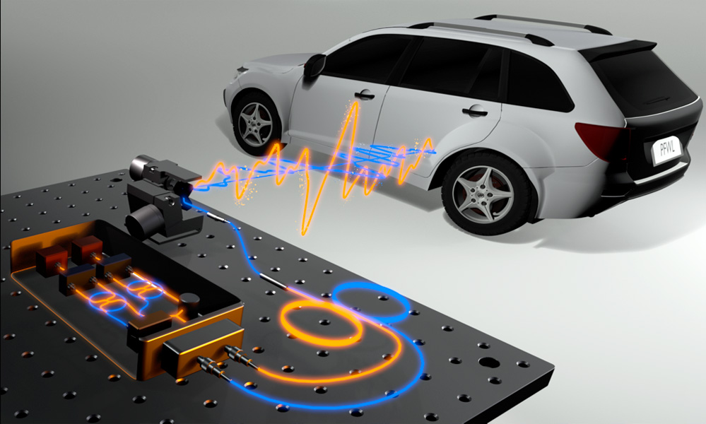
The new lidar system can simultaneously measure the location, speed and material properties (polarization) of objects in a scene, which could be useful for autonomous driving. Credit: Dongyu Du, University of Toronto.
Researchers at the University of Toronto, Canada, have developed what they call “a new kind of lidar system” that simultaneously measures the location, speed and material properties of objects in a scene. This could be useful for applications such as robotics, autonomous driving and remote sensing.
“Although some emerging lidar technologies can also measure velocity, real-world perception often requires understanding an object's surface as well,” said Dongyu Du from the university. “Our new system uses a single measurement at each scanned point to capture millimeter-accurate distance, velocity and surface material while using eye-safe laser power.”
A partnership between Toronto and network technology company Ciena Corp. developed the new lidar system, which combines new analysis methods with a standard telecommunications device that enables sensing of distance, velocity and surface material by capturing polarization information.
The achievement is described in the journal Optica.
“Although this work is still at the research-prototype stage, it points toward future sensing systems that could help machines understand the physical world more reliably,” said Du. “This could lead to safer autonomous vehicles, more capable robots, better industrial inspection and sensing systems that work in poor visibility caused by glare, fog, or heavy rain.”
Adapting telecom technology
The new work grew out of a collaboration between research groups at the university of Toronto and Ciena, which have been exploring how a device called a coherent optical modem could be adapted for lidar. These mass-produced modems can simultaneously measure many different properties of light, including its frequency, polarization, phase and amplitude.
“Coherent optical modems are used to send internet traffic through cities and even across continents by encoding information into light,” said Du. “As a result, they can control and measure light with very high speed and precision, come in compact form factors and naturally solve many of the same sensing challenges encountered with lidar.”
The researchers developed a lidar system that uses a coherent optical modem as the transmitter and receiver. This made it possible to send and detect multiple properties of light with extremely high speed and precision and, thus, extract far more information from each measurement than is possible with a conventional lidar system.
How it works
 The system works by illuminating a target with a laser beam that is randomly modulated at extremely fast speeds — tens of billions of times per second — in two orthogonal polarization channels. While conventional lidar systems measure the time delay between when light is emitted and when it returns to calculate distance, the new system also measures how the polarization properties of light change after interacting with the target surface, making it possible to recover distance, velocity and material properties.
The researchers have also developed a new way to make sense of the measurements, which are difficult to recover and are degraded by noise and unavoidable distortions induced by the lidar system’s internal optics.
“Previous systems lacked the computational tools to separate out the signal of interest from the internal distortions,” said Du. “We developed a new polarization-aware model of how light propagates through our system and interacts with the scene, along with algorithms that can disentangle all of these effects to produce clean estimates of distance, velocity and material properties.”
To test the system, the researchers first compared its depth and velocity measurements to those obtained with other lidar processing methods using controlled scenes with static and moving objects. The new method outperformed existing techniques on both fronts, particularly in challenging low-signal regions where other approaches struggled with noise. They also showed that the system works reliably under strong ambient light, which can cause other polarimetric lidar systems to fail.
The researchers then showed that the lidar system could recover surface material properties of everyday materials, including metals, plastics and objects with varying surface roughness. They also measured polarization speckle — an interference pattern created by laser light — and demonstrated that these patterns carry information about surface roughness, thereby providing a means to characterize materials at fine scales.
Finally, the researchers demonstrated that the polarization information obtained with the system can be helpful for imaging through scattering media with optical thickness up to 4.76. This capability could be useful for imaging in conditions where visibility is limited by fog, rain or dust.


Dissolving microneedles guide light to skin cancers
July 22 2026

Upbeat ASML raises 2026 guidance again
July 22 2026